Historical Official Path Burglichtenberg

Following the traces of the former office of Burglichtenberg, it goes over the ridges of the Westrich...

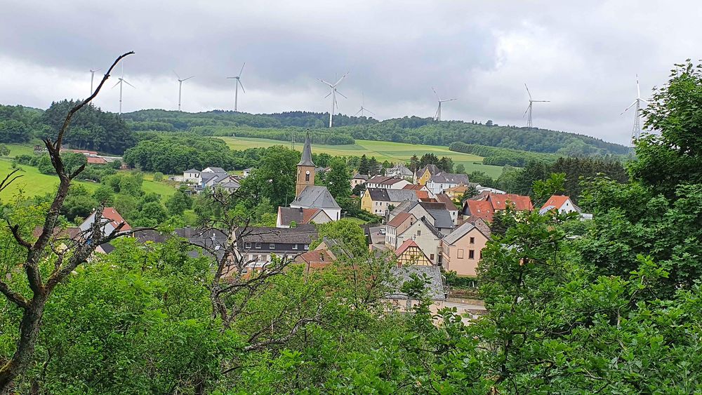
The Historical Official Path Burglichtenberg covers approximately 13.6 km and deals with the history of the former administrative district of Burglichtenberg, which had its main office in Berschweiler.

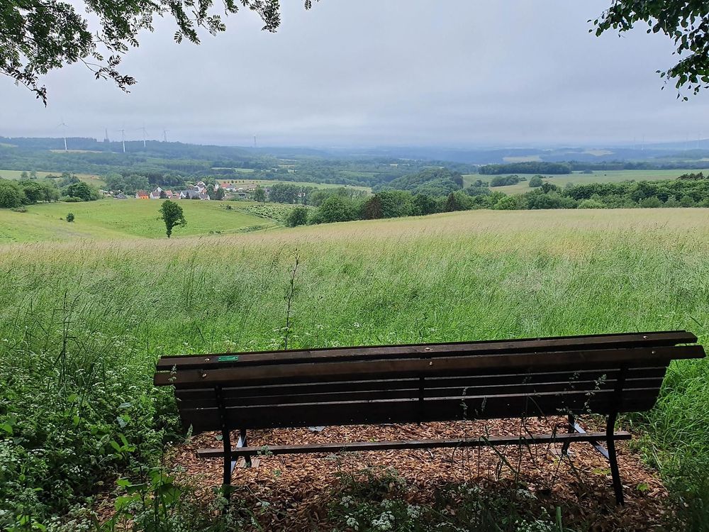
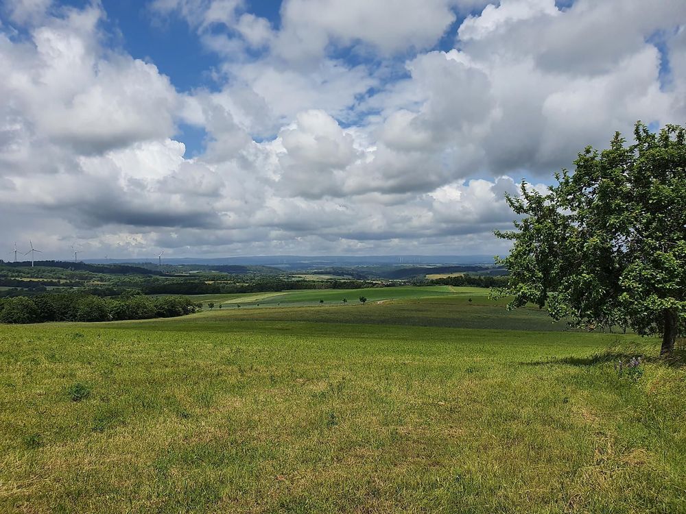
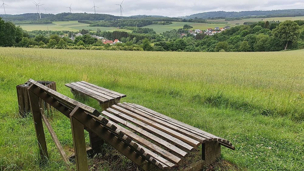
In addition to magnificent views of the Palatinate and the Hunsrück, the hiking trail offers a pleasant variety of meadow and forest paths. The shady passages along small streams are perfect for hikes on warmer days.

Background information on historical buildings can be accessed in audio and video format via a QR code, so be sure to bring your smartphone.

Both in Eckersweiler and in Berschweiler, you can stop for refreshments after the hiking tour on weekends. The village tavern in Eckersweiler and the Albert inn look forward to your visit. Additionally, at Bauersch Platz Berschweiler, vending machines with drinks, pizza, and ice cream are available, ensuring that refreshments during breaks are secured.

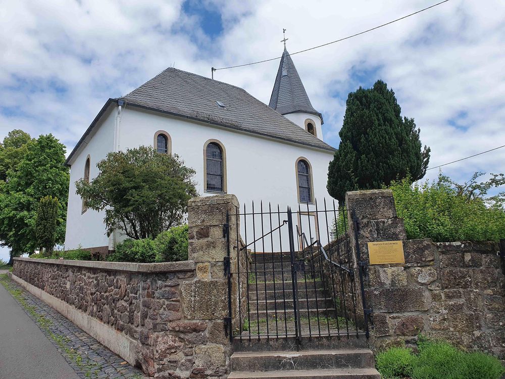
You can start at two points: either in Eckersweiler at the Protestant church or in Berschweiler at Bauersch Platz.

Historischer Amtsweg Burglichtenberg 8v4s1s
Historischer Amtsweg Burglichtenberg l9btd4
Historischer Amtsweg Burglichtenberg 6p3bs
Historischer Amtsweg Burglichtenberg rowb1v
Historischer Amtsweg Burglichtenberg hif823
Historischer Amtsweg Burglichtenberg btaouu
Historischer Amtsweg Burglichtenberg rcju4a

Categories

Educational trail/-s National Park Hunsrück-Hochwald Region POI Nature & Activity (Season Extension) Routes & Tours Thematic Hiking Hiking Hiking trail/-s Winter Hiking
Opening hours
Monday: 00:00 - 23:58
Tuesday: 00:00 - 23:58
Wednesday: 00:00 - 23:58
Thursday: 00:00 - 23:58
Friday: 00:00 - 23:58
Saturday: 00:00 - 23:58
Sunday: 00:00 - 23:58
Address

evangelische Kirche Eckersweiler
55777 Eckersweiler (DE)

Coordinates

Lat: 49.560314
Long: 7.289319

More information

The hike on the Historical Administrative Path Burglichtenberg can be started from two points.

From the

Evangelical Church Eckersweiler
Auf der Acht 1
55777 Eckersweiler

or

Bauersch Platz
Ringstraße 2
55777 Berschweiler

from

Directions to Eckersweiler:

By car

From coming from Baumholder: leave Baumholder via Berschweilerstraße. Then turn left onto L 348. At the next opportunity, turn left towards Berschweiler. Then turn right again towards Berschweiler. Follow Unnertalstraße to Berschweiler. After Berschweiler comes Eckersweiler. In Eckersweiler, you can see the church with the round tower on the left side.

From coming from the A 62 motorway: take exit 5 Freisen. Drive on L 133 towards Baumholder. Follow L348. Then turn right towards Berschweiler. Follow the main road and then turn right onto Am Markt street. The next place is Eckersweiler. In Eckersweiler, you can see the church with the round tower on the left side.

From coming from Kusel: drive over Thallichtenberg towards Baumholder. When you have driven all the way up the mountain, turn left before Breitsesterhof towards Mettweiler. Drive through Mettweiler. After Mettweiler, turn left towards Berschweiler. Drive through Berschweiler. After Berschweiler comes Eckersweiler. In Eckersweiler, you can see the church with the round tower on the left side.

Directly in front of the church, there are parking spaces and the starting point for the hiking tour.

Additional parking spaces can be found about 300m to the right at the community center (Hauptstraße 16)

Directions to Berschweiler:

By car

From coming from Baumholder: leave Baumholder via Berschweilerstraße. Then turn left onto L 348. At the next opportunity, turn left towards Berschweiler. Then turn right again towards Berschweiler. Follow Unnertalstraße to Berschweiler. In Berschweiler, Bauersch Platz is located on the left side at the intersection of Unnertalstraße/Ringstraße.

From coming from the A 62 motorway: take exit 5 Freisen. Drive on L 133 towards Baumholder. Follow L348. Then turn right towards Berschweiler. Follow the main road and then turn left onto Unnertalstraße. Bauersch Platz is located directly in the intersection area.

From coming from Kusel: drive over Thallichtenberg towards Baumholder. When you have driven all the way up the mountain, turn left before Breitsesterhof towards Mettweiler. Drive through Mettweiler. After Mettweiler, turn left towards Berschweiler. Drive through Berschweiler. In Berschweiler, Bauersch Platz is located on the left side at the intersection of Unnertalstraße/Ringstraße.

There are some parking spaces at Bauersch Platz. Additional parking spaces are available at the Evangelical Church Berschweiler (Hauptstraße).


Following the traces of the former office of Burglichtenberg, the route goes over the ridges of Westrich around Eckersweiler and Berschweiler.

The Historical Administrative Path Burglichtenberg deals with the history of the former administrative district of Burglichtenberg over approximately 13.6 km, which had its headquarters in Berschweiler.

In addition to grand views into the Palatinate and the Hunsrück, the hiking trail offers a pleasant variety of meadow and forest paths. The shady passages along small streams are perfect for hikes on warmer days.

Background information on historical buildings can be accessed in audio and video format via a QR code, so be sure to bring your smartphone.

Both in Eckersweiler and in Berschweiler, you can stop for refreshments after the hiking tour on weekends. The village tavern Eckersweiler and the Gasthaus Albert look forward to your visit. Additionally, at Bauersch Platz Berschweiler, vending machines with drinks, pizza, and ice cream are available, ensuring that refreshments are secured during breaks.

You can start from two points. Either in Eckersweiler at the evangelical church or in Berschweiler at Bauersch Platz.